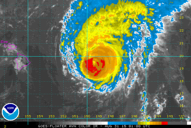
Hurricane watchers can relax a little — the forecasts just keep getting better and better.
While Hurricane Ignacio is still a major hurricane, it was weakening and downgraded to a Category 3 storm Sunday. Rapid weakening was expected, and Ignacio could become a tropical storm by Tuesday, the Central Pacific Hurricane Center (CPHC) predicted.
The center of Ignacio is expected to pass 200 miles northeast of the Big Island and Maui today and Tuesday, but tropical storm watches were canceled Sunday afternoon for those islands.
The biggest risk is likely to be from large swells generated by Ignacio, which will arrive along east- and south-facing shores of the main Hawaiian Islands over the next several days. Surf will be large and potentially life-threatening, especially on the Big Island and Maui, forecasters warned.
“Right now, the current track, we’re not expecting the hurricane to make a direct hit on the Big Island,” said Anthony Reynes, a meteorologist with the CPHC. “Mainly the impacts are going to be very high surf and some strong wind gusts over the coastal waters.”
Meanwhile, Hurricane Jimena was being described as “intense” by the CPHC. Jimena was a Category 4 hurricane moving west-northwestward toward the Central Pacific at 5 p.m. Sunday, when it was 1,525 miles from Hilo.
Hurricane Kilo was also still a major hurricane posing no threat to land. The Category 3 storm was 590 miles west-northwest of Johnston Atoll at 5 p.m. Sunday, moving toward the northwest.
On the other side of the Pacific, another disturbance formed 650 miles south-southwest of Manzanillo, Mexico, and was showing signs of organization. Forecasters said it was likely to become a tropical depression within the next day or two.
Ignacio was 675 miles east-southeast of Lihue and 720 miles east-southeast of Niihau at 5 p.m. Sunday. It was moving toward the northwest at 12 mph.
As the islands prepared for high winds, heavy rain and ocean swells, Gov. David Ige signed an emergency proclamation on Friday.
Big Island farmer Greg Colden said he is most worried about the damage that more rain and sustained winds could do to the area as Ignacio passes by.
“I’m more worried about the rain. We’ve had over 10 inches in August, which is an anomaly for us. The trees are saturated already, and if we get some sustained winds, they could topple. That could cause quite a bit of damage,” Colden said.
Colden is one of the owners of Kona Natural Soap Co. in Holualoa, upslope of Kona Village on the west side of the island, and has 450 coffee trees and 1,250 cacao trees. But he’s not overly worried.
“We’ve gone through this so many times. Unless it whips around the island and we take a direct hit, we should be OK,” Colden said.
Honolulu Mayor Kirk Caldwell said at a Sunday news conference that city officials are preparing to prevent more sewage spills in case the storm touches Oahu, the Honolulu Star-Advertiser reported.
A million gallons of treated but not yet disinfected wastewater spilled from the East Honolulu Wastewater Treatment plant, closing Sandy Beach and its surroundings on Thursday. Last Monday, 400,000 gallons of wastewater spilled in Ala Moana Beach Park after heavy rains associated with Kilo inundated the system.
•••
The Associated Press contributed to this report.


