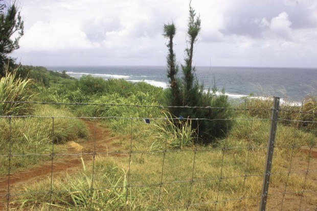
LIHU‘E — Waioli Corporation and Paradise Ranch have the last word — at least for now — in the latest installment of a lengthy battle over the rights to use a lateral trail to access the shoreline at Lepe‘uli, commonly
LIHU‘E — Waioli Corporation and Paradise Ranch have the last word — at least for now — in the latest installment of a lengthy battle over the rights to use a lateral trail to access the shoreline at Lepe‘uli, commonly known as Larsen’s Beach.
“Upon further review of the file, it appears that Boundary Interpretation No. 11-01 was issued without the benefit of a ‘survey map showing the locations of the shoreline as provided for in section 205A-42, HRS,’” Land Use Commission Executive Officer Orlando Davidson said Wednesday in a letter addressed to Sierra Club Kaua‘i Group, state Board of Land and Natural Resources Chair William Aila Jr. and Donald Wilson, attorney for Waioli Corporation.
Davidson’s action nullifies his previous letter, dated July 25, in which the LUC set Lepe‘uli’s conservation district boundary at 300 feet from the shoreline, placing a fence erected by Paradise Ranch owner and land lessee Bruce Laymon at least 75 feet inside the district.
In his latest letter, Davidson said that according to LUC administrative rules, requests for boundary interpretations should have attached a map showing the shoreline’s location.
The Sierra Club Kaua‘i Group had asked earlier this year for the LUC to provide a conservation district boundary interpretation.
“The party seeking this boundary interpretation did not provide such map,” Davidson said.
Based on the omission, he said Boundary Interpretation No. 11-01 is “rescinded and of no further force and effect.”
Davidson’s latest letter, however, hardly puts the issue to rest. Rather, it leaves an open door for future boundary interpretation requests.
“Should any interested party request a boundary interpretation in compliance with Section 15-15-22 of the Commission’s Rules, we will undertake to process such a request as expeditiously as possible,” Davidson said in the letter’s closing paragraph.
Laymon originally had a conservation district use permit to fence off Lepe‘uli, but he surrendered the permit Jan. 10 before the state Board of Land and Natural Resources could make its decision on a contested case request.
On May 21, Laymon — utilizing a county special management area permit — built the fence on land zoned agricultural just outside the conservation district, as delineated on Jan. 20 by licensed surveyor Alan Hiranaka.
The fence effectively blocked Lepe‘uli’s lateral access, but beachgoers can still access the shoreline through a county easement on the south end of the property.
Some residents have challenged Laymon’s decision, saying the lateral access is the historical Ala Loa, an ancient trail believed to have once wrapped around the island’s coastline.
If the lateral access is identified as the Ala Loa, some concerned community members say the path would have to have open access.
The only ruling Na Ala Hele — the state’s trail and access system — has made so far is it was unable to claim the trail as the Ala Loa because the government did not make a claim for any trails in that area when the land was registered in the Land Court system in 1943.
On June 27, Aila sent a letter to interim Planning Director Michael Dahilig, stating that neither DLNR nor Na Ala Hele have approved the fence’s current location as required by the county SMA permit.
• Léo Azambuja, staff writer, can be reached at 245-3681 (ext. 252) or lazambuja@ thegardenisland.com.


