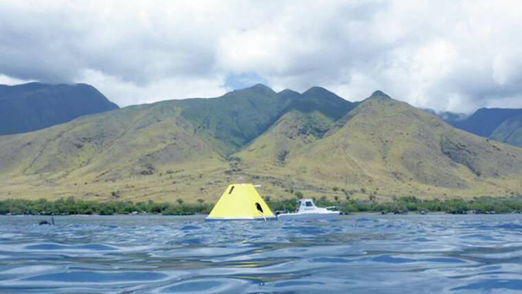
LIHU‘E — Researchers at the University of Hawai‘i at Manoa are set to deploy this summer a research buoy off Kaua‘i’s coast alongside multiple aquatic drones, as part of a project to assess Hawai‘i’s vulnerability to climate change impacts.
Funded as part of a $50 million donation from Priscilla Chan and Mark Zuckerberg, a network of buoys and saildrones scattered around the state will provide scientists with real-time data highlighting whether the island chain’s nearshore waters are accumulating fossil fuel emissions.
“Collecting this data is important for Hawai‘i because it’ll tell us more about different hot spots around each of the islands, where we might want to pay attention to how the water chemistry and water quality is changing in those areas,” said Amy Markel, UH-Manoa oceanography doctorate student.
Approximately 25 and 30 percent of human-made carbon dioxide emissions is absorbed by Earth’s oceans. When those emissions meet water, chemical reactions create carbonic acid, radically changing the ocean’s pH levels. According to the National Oceanic and Atmospheric Administration, CO2 created following the Industrial Revolution has increased ocean acidity globally by about 30 percent.
This shift in aquatic environments has had immense impacts on marine life — and, in particular, organisms that create calcium carbonate, such as corals, oysters and crabs. Acidic water makes it much more difficult for these species to produce shells and skeletons, slowing their growth and leaving them susceptible to disease.
“That’s the primary effect that we’re focusing on — in this case, for the Hawaiian Islands — is the impact that ocean acidification will have on our coral reefs,” Christopher Sabine, UH-Manoa oceanography professor and interim vice provost for research and scholarship, told The Garden Island when the saildrone project was first announced in April. “Because, of course, the coral reefs are critical for tourism, for protecting our coastlines from storms, for cultural practices and subsistence fishing.”
To create a more thorough dataset of the island chain’s waters, researchers plan to make use of both buoys’ and saildrones’ respective strengths.
Two existing buoys off the coast of Windward O‘ahu and one off Maui’s coast, along with two additional buoys planned for summer deployment — one off Kaua‘i and one off Hawai‘i Island — will provide detailed data for individual locations over a longer period.
Conversely, three saildrones zigzagging between the islands’ coastlines and 5 kilometers offshore will collect atmospheric and oceanic data as each one travels, significantly increasing where the team can study.
“The saildrones — these autonomous sailing boats that are surveying all the way around O‘ahu and the other islands — allow us to connect the time information we get from the buoys with the spacial information collected from these moving platforms,” Sabine said.
With these data-collection methods, the research team plans to develop maps indicating where along Hawai‘i’s waters organisms producing calcium carbonate are most vulnerable to the impacts of climate change.
For the project to be successful, Sabine asks mariners to stay 500 meters away from the instruments, adding that the devices will not collect any data that can be used to identify people, marine mammals or fish locations.
“The saildrones look like sailboats, and they’re working very close to shore, so if you see them please don’t touch them or interfere with their operations,” Sabine said. “They are being remotely piloted and they’re operating in safe waters.”
The project is a collaboration between UH-Manoa, the National Oceanic and Atmospheric Administration’s Pacific Marine Environmental Lab, the Cooperative Institute for Climate, Ocean and Ecosystem Studies and Saildrone Inc. The saildrones’ mission started on April 1 and is planned to conclude by October.
•••
Jackson Healy, reporter, can be reached at 808-647-4966 or jhealy@thegardenisland.com.


Hey we like know the effect of sewage has on the reefs- So many cesspools!!!