HA‘ENA — A techie and part-time island resident has created a free, augmented-reality iPhone app to educate and entertain Kaua‘i beachgoers.
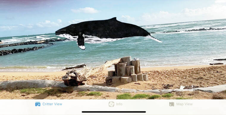
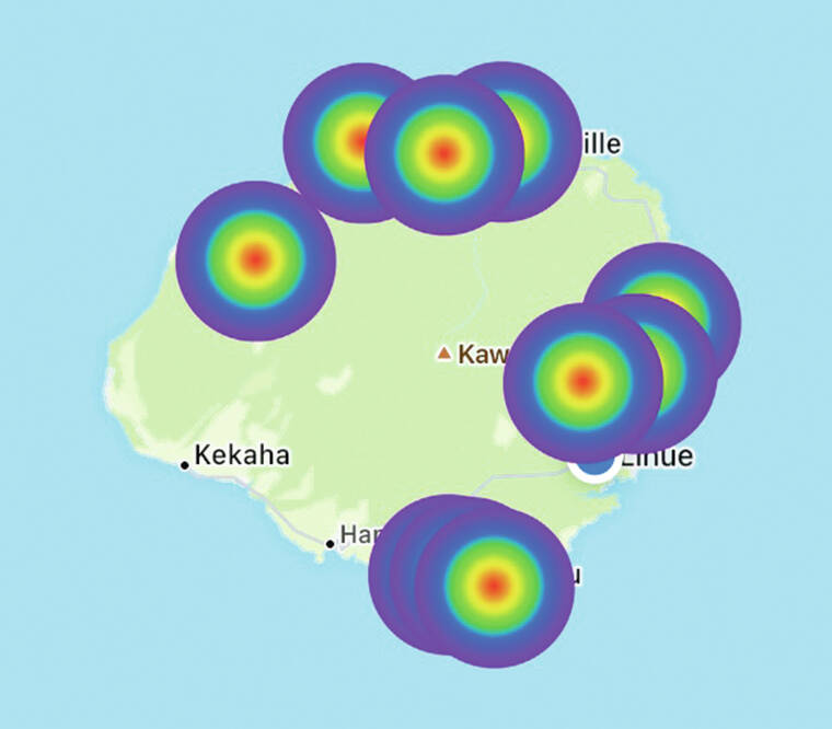
“Explore Kaua‘i” features 10 rainbow-colored dots plotted across a map of the island, which includes the North Shore’s Ha‘ena Community-Based Subsistence Fishing Area. When app users reach one of the rainbow-colored points, a 3D render of a marine animal appears on their iPhone’s camera screen.
“The cool thing about it is that the creatures — because they’re AR (augmented reality) — they are all truly 3D,” said Med Dyer, who made the app with assistance from the state Department of Land and Natural Resources Division of Aquatic Resources.
“A lot of them, you can walk all the way around them, you can look at them from the top and the bottom,” Dyer continued.
The app developer said “Explore Kaua‘i” can be compared to the popular game “Pokémon GO,” which also uses a smartphone’s camera to superimpose digital critters onto the real world.
An octopus on Lawa‘i Beach, a Moorish idol at Wailua Falls, a spotted ray at Koke‘e Lodge, a whale at Lydgate Park and a sea star at ‘Anini Beach Park make up half the animals that can be found in “Explore Kaua‘i.”
But they are not the app’s point, according to Dyer.
“I want people to think about the AR stuff because that’s the fun part for people who are coming over to visit,” he said. “But really, this is almost like a little bit of a trick to get them to download it and then have the CBSFA info when they go there.”
Dyer is particularly concerned with the subsistence fishing area’s Makua Pu‘uhonua fish refuge, located off Tunnels Beach (Makua). Neither vessels nor individuals are allowed to enter the spot without a permit.
“If you ask people if they’re aware that there’s a pretty significant chunk of Tunnels where you’re not allowed to go in the water, nobody knows about it,” Dyer said.
“And that is the crux of the Makua Pu‘uhonua … Everything has to stay out of it in order for it to be a valid test. Because what DAR is doing is, they’re looking at it on a time basis to see, ‘Does it recover as a result of not having any activity?’”
The CBSFA is already demarcated by beach signage and GPS coordinates.
“For an average person, it’s just really hard to tell where it is,” Dyer said. “Whereas it’s much easier with this (app), because you can see exactly relative to where you are.”
Dr. Heather Ylitalo-Ward, a Kaua‘i-based DLNR-DAR aquatic biologist, agreed many visitors have not heard of the Pu‘uhonua area, and are unaware they aren’t permitted to swim, kayak, stand-up paddle or fish within its boundaries.
“We are hoping that this app will bring more awareness to these special places and give people a fun way to explore the island,” Ylitalo-Ward said.
Ylitalo-Ward and other DLNR-DAR personnel weren’t the only ones to help make the “Explore Kaua‘i” app a reality.
North Shore residents, island Facebook group members and a few “tourist types” provided feedback throughout a six-month testing period.
The passion project took 18 months to complete in total, according to Dyer, who previously released a Kalalau Trail video game under his LLC, CraniaLab.
“Explore Kaua‘i” can be found online in the Apple App Store.
•••
Scott Yunker, reporter, can be reached at 245-0437 or syunker@thegardenisland.com.


