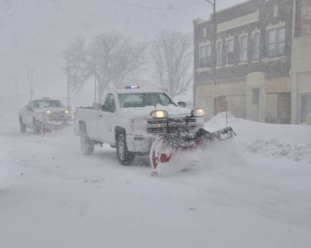
OMAHA, Neb. — A blizzard that paralyzed parts of Colorado and Wyoming barreled into the Midwest on Thursday, bringing whiteout conditions to western Nebraska and dumping heavy rain that prompted evacuations in communities farther east.
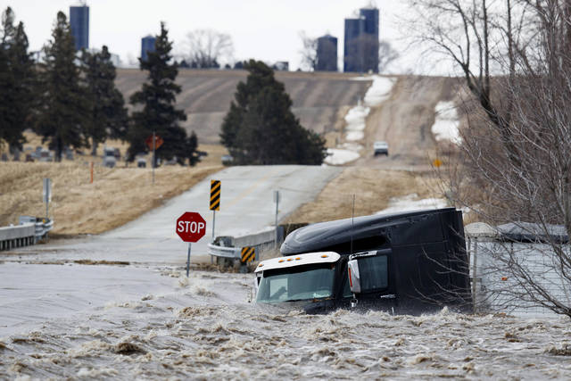
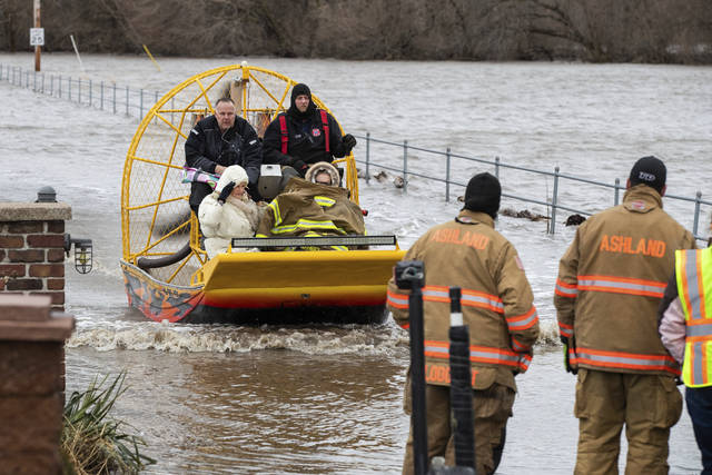
Emergency crews responded after a vehicle was swept off a road in Norfolk, Nebraska, and rising water along the Elkhorn River prompted evacuations in the city of 24,000 people. The missing individual had not been found by midday Thursday.
Evacuations also occurred in several other eastern Nebraska communities and at least one Iowa town. Cara Jamison and her neighbors had to leave their homes in Fremont, Nebraska, after water and ice chunks from a flooding Platte River blocked their street.
Jamison and her husband moved photo albums and important papers to the second floor of their home before checking in to a hotel Wednesday. They hoped to return home Friday.
“Photos are the important things,” she said. “Furniture can be replaced.”
South Dakota’s governor closed all state offices Thursday as the blizzard conditions moved in, while wind, blowing snow and snow-packed roadways also made travel treacherous in western Nebraska.
Heavy rain caused flooding in eastern parts of both states, as well as in Iowa. Several cities in the region have been hit by rain this week, with records set Wednesday in Sioux Falls, South Dakota, and Sioux City, Iowa.
“We’ve got a lot of water, and it’s got to find a way to get out of here,” said Tracy West, mayor of Lennox, South Dakota, where the 2,400 residents were asked to conserve water to prevent an overwhelming of the city’s wastewater system.
National Weather Service meteorologist Peter Rogers said flooding is likely to persist into the weekend, with deeply frozen ground preventing water from rain and snowmelt from soaking into the soil.
The massive late-winter storm hit Colorado on Wednesday, causing widespread power outages, forcing the cancellation of hundreds of flights and wreaking havoc on roadways as drivers became overwhelmed by blinding snow. A wind gust clocked in at 97 mph (156 kph) in Colorado Springs.
Xcel Energy said it had restored power to some 360,000 customers in Colorado but that thousands remained without electricity Thursday. Some may have no power into the weekend.
In the Texas Panhandle, a utility worker was killed while working to restore power amid strong winds pushed in by the storm. Wind gusts in the area exceeded 80 mph (128.74 kph). And in New Mexico, 36 miners at a nuclear waste repository were trapped underground in an elevator for about three hours because of a power outage caused by the extreme weather. Outages also were reported from North Dakota to Nebraska.
The storm also contributed to the death of Daniel Groves, a Colorado State Patrol officer who was hit and killed by a car as he helped another driver who had slid off Interstate 76 near Denver.
About 50 National Guard soldiers and airmen used specialized vehicles with tank-like treads to rescue 75 people stranded in their cars during the storm, along with two dogs, according to spokeswoman Elena O’Bryan. The total number of people rescued statewide is likely higher, as local law enforcement ran separate rescue efforts.
The Red Cross reported Thursday that 620 people had stayed in shelters overnight in Colorado and Wyoming.
Jackie Ratcliff stayed in a hotel and on Thursday was waiting in Wellington, Colorado, for Interstate 25 to reopen so she could return to her home in Cheyenne, Wyoming. She had tried to make the trip Wednesday but the interstate was shut down due to a pileup — one she thinks she narrowly avoided.
“I’m feeling pretty lucky,” she said, despite her dog at home needing to be fed.
The window-rattling storm brought blizzards, floods and a tornado across more than 25 states Wednesday, stretching from the northern Rocky Mountains to Texas and beyond.
Five people were hurt and 150 dairy cows had to be euthanized when a tornado hit the small town of Dexter, New Mexico, about 200 miles (320 kilometers) southwest of Albuquerque. High winds knocked 25 railroad freight cars off a bridge in northeast New Mexico, but no one was hurt.
The culprit was a sudden and severe drop in ground-level air pressure in Colorado, the most pronounced dive since 1950 and something “that will go down in the history books,” said Greg Carbin, chief of forecast operations for the National Oceanic and Atmospheric Administration’s Weather Prediction Center.
It was caused by a combination of the jet stream and normal conditions in the wind shadow of the Rockies. Air rushed into the low-pressure area and then rose into the atmosphere, causing severe weather.
Meteorologists call the rapid change in pressure a “bomb cyclone” or “bombogenesis.”
———
Nicholson reported from Bismarck, North Dakota. Also contributing were Associated Press reporters Dan Elliott in Longmont, Colorado; Bob Moen and Mead Gruver in Cheyenne, Wyoming; Gretchen Ehlke in Milwaukee; James Anderson and Thomas Peipert in Denver; Jeff Baenen in Minneapolis; Josh Funk in Omaha, Nebraska; Seth Borenstein in Washington; David Warren in Dallas; Kathleen Foody in Denver.


