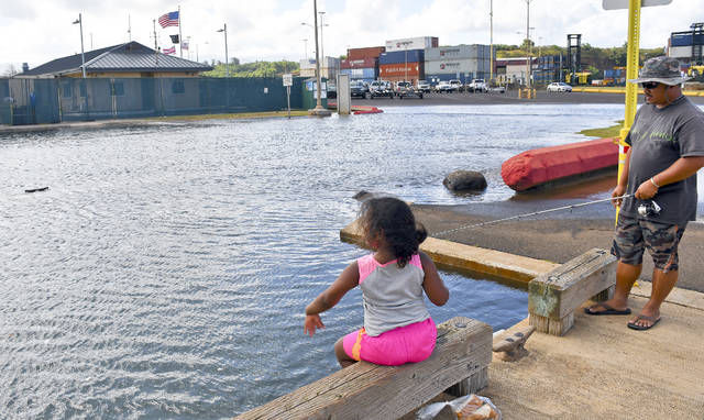
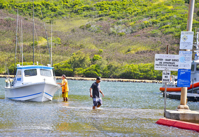
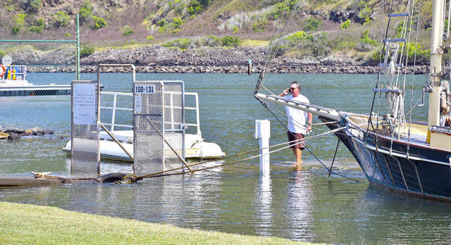
NAWILIWILI — King tides brought the ocean up 3 feet at Nawiliwili Harbor on Friday afternoon, higher than the predicted 2.35 feet according to the National Oceanic and Atmospheric Administration. And the water level rise could be seen through out
NAWILIWILI — King tides brought the ocean up 3 feet at Nawiliwili Harbor on Friday afternoon, higher than the predicted 2.35 feet according to the National Oceanic and Atmospheric Administration.
And the water level rise could be seen through out the island, particularly on the Eastside where a swell generated by the distant Hurricane Fernanda is contributing to increased surf.
“Depending on high tides and the surf, the east exposed shorelines might see increased wave run-up because of the distant storm,” said Ruby Pap, coastal land use extension agent for the University of Hawaii Sea Grant College Program.
The Eastside is where Pap went Friday to document the third in the series of this summer’s king tides for the Hawaii and Pacific Islands King Tides Project.
The project is a citizen science effort managed by the UH Sea Grant Program that’s been ongoing for three years to chronicle high water levels.
“We have this citizen science app that lets people take a picture with their phone and the phone’s internal GPS collects the relevant information and sends it directly to our site,” Pap said. “It’s much easier than it was when we started.”
The data collected provides a glimpse at regular water levels in the future, matching scientists’ predictions of increased recurring flooding due to climate change and sea level rise.
“By starting to document these now with photos, we’re not only collecting viable data on what areas of our coastline are vulnerable, but we’re also educating community members on what’s’ to come,” Pap said.
King tides aren’t an unusual event. Researchers have been using them for years to study coastal erosion and determine sea level changes, but they’re drawing more attention this year.
That’s because the water levels around Hawaii have been 6 to 10 inches above the predicted tides under normal conditions since early 2016.
“There’s been elevated water levels across the state for quite some time and when you add the king tides, it makes them even higher,” Pap said. “That’s why it’s getting so much attention this year.”
The elevated water levels are expected to persist throughout the summer and possibly recede; however, now it’s creating what scientists call a stacking effect.
“With these elevated water levels and when the king tides come, you can really start to see some nuisance flooding,” she said.
That nuisance flooding is what community members should be guarding against, according to Elton Ushio, emergency management administrator for the Kauai Emergency Management Agency.
“Properties, facilities and infrastructure historically prone to coastal flooding or erosion are the primary areas of concern,” Ushio said.
Increased coastal erosion, wave over-wash and flooding, reduced drainage and temporary ponding in low-lying areas are all possibilities as the king tides continue through the weekend, subsiding on Sunday.
“If folks live in an area that’s prone to flooding or if they live close to the shoreline, just move things out of the way,” Pap said.
People should be extra cautious going to the beach as well, according to Pap and Ushio, because the tides could cause unusual ocean conditions.
“Beachgoers should be aware and also exercise caution, given the potential for stronger currents and rip-currents associated with the higher than normal tides, along with the arrival of the east swell,” Ushio said.


