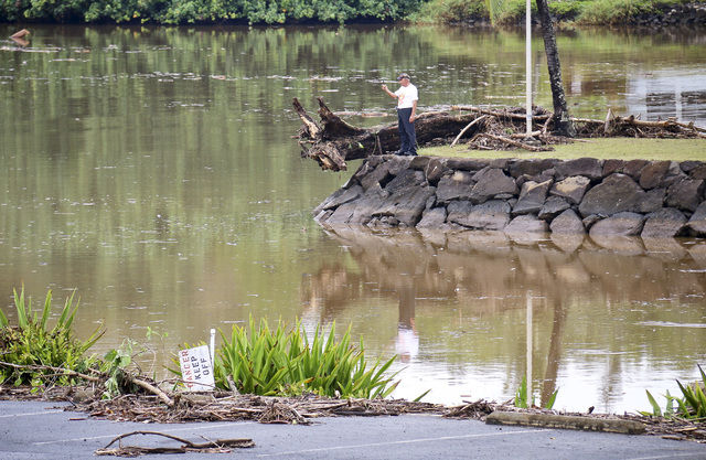
LIHUE — Torrential rains that drenched Kauai for several hours late Thursday and early Friday morning didn’t shatter any weather records, but the region got more than anticipated. “We knew it was coming — but we didn’t know it was
LIHUE — Torrential rains that drenched Kauai for several hours late Thursday and early Friday morning didn’t shatter any weather records, but the region got more than anticipated.
“We knew it was coming — but we didn’t know it was coming in buckets,” said Jon Jelsema, senior weather forecaster for the National Weather Service in Honolulu.
Hardest hit was the North Shore, where about 10 inches deluged the area, prompting numerous flash flood alerts, brief road closures, drifting debris, rising rivers and traffic delays. Elsewhere on the island, between 6-8 inches of rain was recorded with wind gusts peaking at 30 mph near Hanalei.
The island has seen unseasonably dry conditions over the past several months.
“To get this much rain this fast is definitely an anomaly but it is something the island really needed,” Jelsema said, “and allowed for the excess water to be more quickly absorbed.
Elton Ushio, emergency management administrator with Kauai County, said it was fortunate the ground was so dry when taken into consideration how quickly the downpour moved in.
“The rains were pretty steady at first just like most of us expected and then, ‘boom,’ it really hit hard,” Ushio said Friday afternoon.
Drier conditions are expected throughout the weekend on Kauai with a slight to moderate chances of scattered showers and thunderstorms today and into Sunday, Jelsema said. Highs will be in the upper 70s with lows in the mid-60s.
“We’re looking at some variable winds and some rain,” he added. “But the worst is behind us.”


