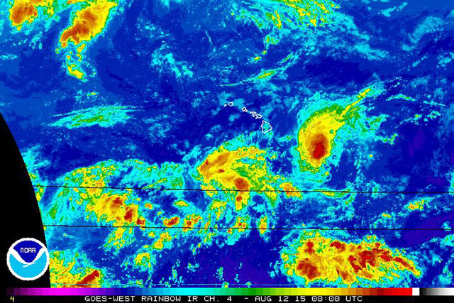
A westerly vertical wind shear continues to weaken Hilda, as the cyclone continues on a southerly track toward the islands, meteorologists from the National Oceanic and Atmospheric Administration said Tuesday. Matt Foster, NOAA meteorologist, said an upper trough 500 miles
A westerly vertical wind shear continues to weaken Hilda, as the cyclone continues on a southerly track toward the islands, meteorologists from the National Oceanic and Atmospheric Administration said Tuesday.
Matt Foster, NOAA meteorologist, said an upper trough 500 miles north of Oahu is forecast to stay in place, which will continue to weaken Hilda in the next several days.
“Our trade winds blow from the east and that upper trough causes strong westerly winds like a strong jet stream over the state,” he said. “Essentially you have two conflicting directions and that’s a hostile environment for any kind of tropical cyclone, when you have a shear environment when you have strong winds on top of it. It’s essentially pulling (Hilda) apart.”
As of 5 p.m. Tuesday, Hilda was a tropical storm and had winds of 65 mph.
Hilda was 590 miles southeast of Kauai and was moving west on Tuesday. It is expected to become a tropical depression this evening or Thursday, according to forecasts.
Foster said a tropical storm watch and a flash flood watch are in effect for the Big Island. The usual tropical storm conditions and winds are 40 mph or greater, he said.
“Wind models are putting a lot of rain over the Big Island,” he said.
A tropical storm watch is issued when tropical storm conditions are possible within 48 hours.
According to forecasts, the islands are expecting a mixture of trade winds and moisture from the Hilda Thursday into Friday.
“As far as the other islands, it looks like some of the moisture starts,” Foster said. “It may get some of that mixed in with the trades and pushed over the other islands, but as of right now we don’t have any highlights for them yet.”

Subscribe today for unlimited access.
Already a subscriber?
Login
Not ready to subscribe?
Register for limited access.
If you have a print subscription but require digital access,
activate your account.


