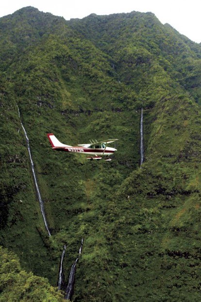
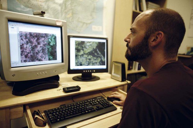
Improved imaging quality and new software technologies have scientists aiming to map, locate and eliminate invasive plant species before they have a chance to threaten Hawai‘i’s delicate watersheds.
The Nature Conservancy of Hawai‘i announced Wednesday that a $1.1-million grant from the Joseph and Vera Long Foundation will help to fund imaging technology to protect the state’s native watersheds and forests from invasive weeds and animals.
“This grant makes meaningful conservation possible and will dramatically increase the scale and effectiveness of our statewide efforts to protect Hawai‘i’s native forests,” said Suzanne Case, director of the Nature Conservancy of Hawai‘i, in a press statement.
The work has already started with lower resolution mapping for the removal of the Australian tree fern, a highly invasive plant that grows an average 30-feet high and 15-feet wide, according to Trae Menard, The Nature Conservancy’s Director of Forest Conservation and director of the Kaua‘i Watershed Alliance.
“It displaces a lot of native trees over here and takes over as a forest of its own plant,” Menard said in a phone interview Thursday.
The fern began appearing in Hawai‘i in the 1970s and began spreading slowly over a 15-year period, he said. During the last decade, the plant presented the potential to alter the Alaka‘i watershed and dominate the canopy of vegetation in the watershed.
New image resolution of up to one centimeter per pixel allows analysts to identify and map much of the younger small-leafed plants. Menard describes this as “a real game changer for managing forests and an even bigger game changer for monitoring forests over time — detecting large-scale changes over long time periods.”
“It is twice the resolution,” he said. “If you look at a five-by-five comparison of a two-centimeter and a one- centimeter image, the difference is night and day.”
The improved imaging is made possible with better cameras that allow more area to be filmed from higher altitudes. It is also made possible by a software-engineering breakthrough from Israeli scientists, Menard said. Two engineers flew from Tel Aviv to Hawai‘i to show them how to use the system to make the photo analysis process much faster.
“These are extremely high resolution images,” he said. “Nobody has this anywhere in the world.”
Once up and running, Menard said the team will conduct aerial mapping to locate more ferns and eliminate them before they spread throughout the watershed. “We can pick out plants in such detail that we can identify which are the bad ones to eliminate,” he added.
Even before the grant, he said the team was mapping with a two-centimeter-per-pixel resolution from the center of the island to Lumaha‘i and Ni‘ihau, and around Wainiha, Hanalei and Wailua. After another year of mapping, they will remove the plants with low-volume herbicides on more than 5,000 Australian tree fern plants in Kauai’s forests, Menard said.
The herbicide technology was created by Dr. James Leary, an invasive-weed specialist with the University of Hawai‘i at Manoa Agricultural Research Center. He loads a compressed air gun with herbicide-filled paintballs that can target specific plants without overspraying and damaging surrounding vegetation.
Other project members include Dana Slaymaker, a resource mapping specialist, and Stephen Ambagis, an image analyst. The fixed-wing and helicopter team is Airborne Aviation on Kaua‘i. The mapping company is Resources Mapping Hawai‘i.
The team will remap in three years to look for growback. In the meantime, Menard said the technology will expand to search out a long list of other small-leafed weed species spanning 20,000 acres of forest land across the state Hawai‘i, including the miconia and the strawberry guava.
There are also other research groups looking at applying the technology to other science not even anticipated during concept, design and then the mapping.
“The possibilities are endless,” said Menard.
Another innovation will be to develop a Web portal to allow land managers and researchers across the state to access the conservation data and images. With support from the grant and the Hawai‘i Community Foundation’s Island Innovation Fund, the Conservancy will provide “real-time access to information in the interest of protecting Hawai‘i’s native forests, according to a press statement from Jason Sumiye, Conservancy’s Hawai‘i Director of Landscape Science.
The results will also be published in articles and presented at forums on conservation innovation to help partners adapt these new technologies to their own applications. Some of the Conservancy’s early aerial mapping technology is already being used by state conservation agencies and private landowners.
“We are developing, using and sharing critical technologies with the potential to revolutionize forest conservation in Hawai‘i and beyond,” Case said in the release.
“We are pleased to support The Nature Conservancy and its efforts to protect Hawai‘i’s native forests. These forests supply the fresh, clean water on which Hawai‘i’s people depend and are biological treasures vital to preserving the islands’ natural and cultural heritage,” Nick Piediscalzi, Joseph and Vera Long Foundation trustee, stated in the release.
• Tom LaVenture, staff writer, can be reached at 245-3681 (ext. 224) or by emailing tlaventure@ thegardenisland.com.


