‘Okolehao Trail, named for “moonshine,” refers to the distilled liquor made from the roots of ti plants during Prohibition. The literal translation, “iron bottom,” a friend told me, refers to “falling down drunk.” Either way, it’s still an accurate description
‘Okolehao Trail, named for “moonshine,” refers to the distilled liquor made from the roots of ti plants during Prohibition. The literal translation, “iron bottom,” a friend told me, refers to “falling down drunk.” Either way, it’s still an accurate description of one’s potential demise while climbing the steep incline of ‘Okolehao Trail in Hanalei.
The first half mile of ‘Okolehao Trail imposes a 30-to-40-degree climb, which could explain why I rarely run into other hikers on my monthly trips there.
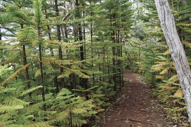
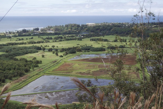
This two-mile hike climbing 1,200 feet is worth the initial effort with a payoff of view after view of Hanalei. The trail follows the Hihimanu Ridge, offering peeks through Norfolk pine and pandanus of Hanalei Bay on one side and Waioli Valley on the other. Ti, wild orchid, eucalyptus and hala line much of this well-maintained trail.
Once hikers have huffed their way up to the first view, the path levels out a bit but continues to rise along the ridge, culminating with a panoramic view of the valley.
Thanks to the hard work of Kaua‘i Sierra Club volunteers, the trail was resurrected after Hurricane ‘Iniki when it became choked with debris and fallen trees. Volunteers spent eight years hauling chain saws and weed-whackers up the ridge for trail clearing, and today this easily navigable trail has easy access.
The trail begins at the China Ditch off Hanalei River. Take Ohiki Road, a one-lane road skirting the taro fields at the north end of Hanalei bridge, and drive 0.7 miles to the U.S. Fish and Wildlife Service parking area. Across the street is a small bridge marking the trailhead.
Follow the shaded trail to the right where it turns abruptly left for the climb up. The beauty of this hike is you don’t have to hike to the end for a payoff — the first stunning view is just a half-mile up. From there you can walk the remaining mile and a quarter to the end for a full panoramic, or just enjoy all the glimpses through foliage.
Tennis shores or Tevas work for this trail. My only word of caution is if you hike just after a rain the descent can be pretty slick. Netting offers some traction, but it is torn in many spots and could be more of a hazard than actual help.
Boggy in the shaded flats and slick on the ascents, hike with caution on rainy days — and this being the North Shore, there are many.
And remember, never leave any valuables in your vehicle. This secluded spot is not well-trafficked, and could be a tempting place for thieves.


