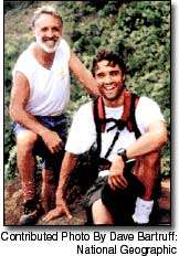
A fresh look at Kaua‘i’s geological origins
Geologist Chuck Blay of Po‘ipu is one-by-one studying and explaining the geological features of Kaua‘i.
In his newly-released edition of “Kauai’s Geologic History – A Simplified Guide,” Blay is providing new information on how Na Pali’s cathedral-like valleys were formed.
In recent decades geologists surmised that the existing Na Pali coast was formed in great part by large collapses of the coast. Evidence appeared in the late 1980s when advances in sonar gave a clear picture of the ocean bottom off the coast of the Hawaiian Islands.
A recent oceanography cruise that Blay participated in has added a new perspective to the theory, and a return to the belief that the rugged coastline was mostly formed by stream runoff and wave action.
“The stuff on Na Pali is immense,” Blay said in an interview with The Garden Island. “I wrote it up as a ‘geocontroversy’ and then got to participate in the UH oceanographic research cruise to test it out. The result was mind boggling. Discovering that the cliffs are most likely a result entirely of wave erosion was a huge surprise to me and several other researchers.”
Blay also provides new, colorful diagrams created by his son, Rob Siemers. Together the father and son run educational tours of Kaua‘i’s natural history, as well as publishing documentation on Kaua‘i’s geology through TEOK Investigations, their Po‘ipu-based company.
A significant illustration details the rainfall at Wai‘ale‘ale, the peak on Kaua‘i considered to be one of the wettest spots on earth.
Blay said: “Compilation and statistical analysis of the Wai‘ale‘ale rainfall data is pretty new; at least it presents it in a more completely-documented manner which relates the weather to Kaua‘i’s location within the trade wind belt as well as to this island’s geography, which is of course a direct result of its geologic history. It also is important to understand the distribution of the island’s environmental systems as related to the uneven distribution of rainfall.”
Geology buffs will find an update of a map of Kaua‘i that illustrates geological aspects of the island’s development.
“I spent a tremendous amount of time on this diagram in order to incorporate as much of the abundant new geologic/oceanographic information that has been generated over the past 20-plus years,” Blay said.
The veteran geologist — who has taken up residency on Kaua‘i following years teaching geology and working in the field — also added information that debunks the common belief that American author Mark Twain first referred to Waimea Canyon as “the Grand Canyon of the Pacific.”
“Documenting the stuff about Mark Twain was a lot of fun and might be considered somewhat of a ‘new’ discovery,” said Blay, who consulted with Anita Manning and Desoto Brown of the Bishop Museum on the issue. Manning’s research shows Twain never visited Kaua‘i during his Hawai‘i sojourn in the mid-1860s, and that the reference first appeared after 1900.

